Geoinformatik
Advertisement
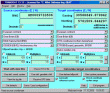

SEVENPAR (English)
The program produces a set with seven parameters of the sapatial Helmert transformation valid for an specific area, with which then arbitrary coordinates of the area can be transformed from one reference system into another with high accuracy. The
Advertisement
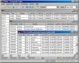
Geodaten International Admin
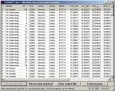
Geo data international world-wide with towns, town quarters and postal codes. Georeferences as UTM- and geographic coordinates (WGS84) and elevations. Suitable for branch searches, periphery searches and distance computations. Australia, Austria,
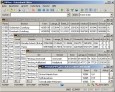
Geodaten German Admin
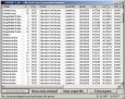
The database contain geodata of the Federal Republic of Germany with geo referenced towns, municipalities, town quarters, administrative units, postal codes, telephone preselections, nature areas, landscapes, climatic zones. The data contain coordinates
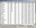
Geo Data International Streets
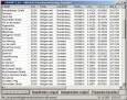
For many countries street coordinates are present with coverage degrees of 100 percent. The geo data offered here are in high-precision quality and are present in several coordinate and reference systems (Geographic, UTM / WGS84, ETRS89). Street
Geo Data International Houses
For many countries house coordinates are present with coverage degrees of 100 percent. The geo data offered here are in high-precision quality and are present in several coordinate and reference systems (Geographic, UTM / WGS84, ETRS89). House Coordinates
Geo Data German Houses
For the area of the Federal Republic of Germany more than 19 million House Coordinates with a coverage of 100% are available. The geo data offered here are in high-precision quality and are present in several coordinate and reference systems.
Geodaten German Streets
For the area of the Federal Republic of Germany more than 1.5 million street coordinates with a coverage of 100% are available. The geo data offered here are in high-precision quality and are present in several coordinate and reference systems.
OCAD v.10.4.12.1072
OCAD is a software program for drawing maps of all types. Thanks to the simple handling and prepared set of symbols and signatures, you will be able to draw perfect maps based on scanned originals in a short time.
OCAD Viewer v.10.4.10.1042
OCAD 10 Viewer is the free edition to view, print and export OCAD maps and OCAD course setting projects. When viewing a map you will be able to pan it, zoom it in and out.
OCAD CS v.10.0.1.694
OCAD CS Course Setting is the OCAD edition for orienteering sports course setters and course controllers.
OCAD Professional v.9 5
OCAD - The software for cartography for drawing maps of all types is available as a Standard and Professional-Edition.